Planning the perfect Bali itinerary starts with understanding the island’s distinct regions. To help you easily navigate your 2026 trip, we have curated a comprehensive guide to Bali’s geography. Explore our complete map breaking down the most strategic areas to stay, pristine beaches, and must-see historical landmarks across the Island of the Gods.
Understanding the Island’s Geography and Regions
Bali covers approximately 5,780 square kilometers, and when viewing a Bali map, one can clearly see the majestic volcanic chain that serves as the island’s spine. This mountain range, dominated by Mount Agung which stands at 3,031 meters, creates a distinct climatic and cultural divide.
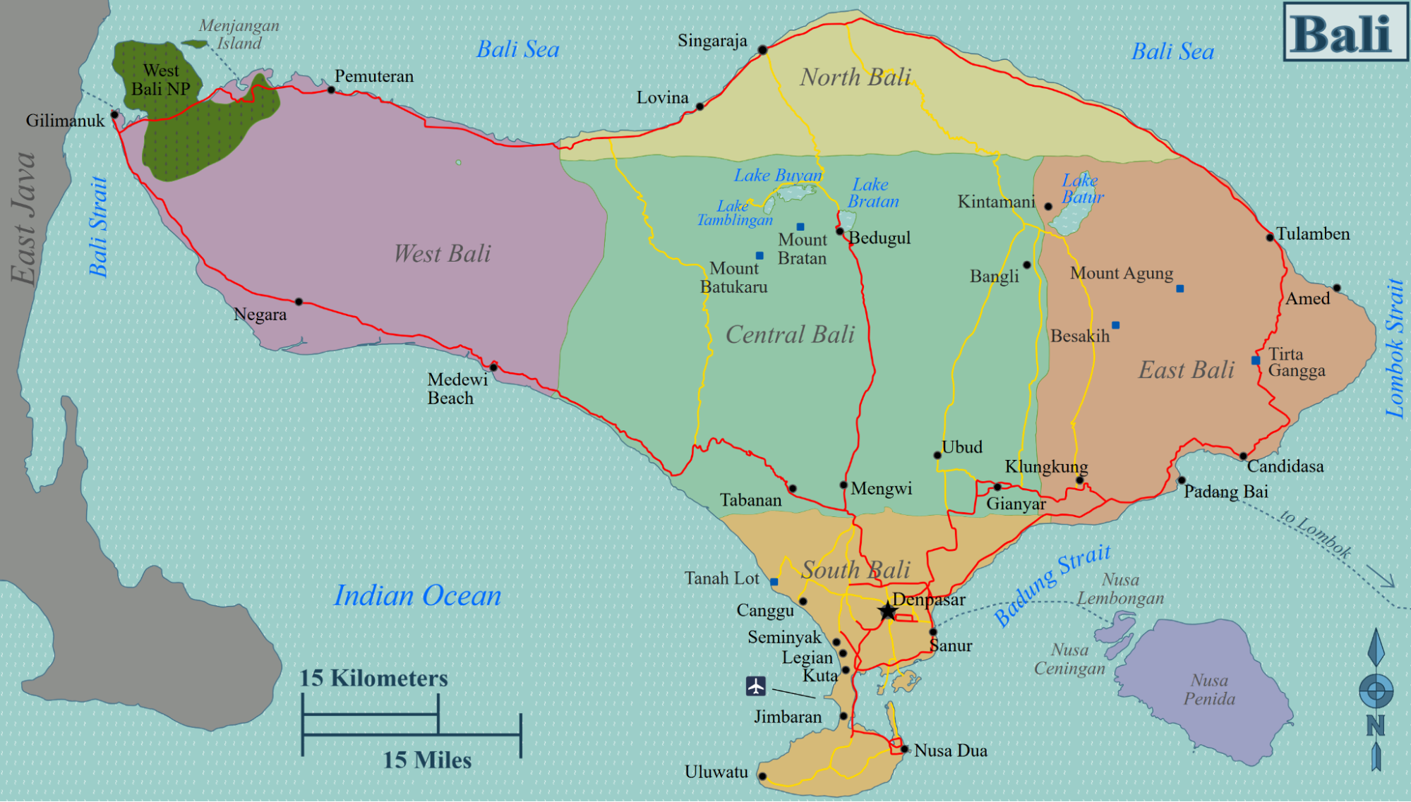
The northern coast is characterized by black volcanic sand and calm waters, offering a secluded and traditional environment. In contrast, the southern regions are defined by white limestone cliffs, expansive surf breaks, and the majority of the island’s premium tourism infrastructure.
The island is historically divided into eight regencies, with the capital, Denpasar, acting as the central administrative and commercial hub. When studying the Bali map for 2026, you will notice the significant impact of the new Sanur Special Economic Zone (SEZ), which has positioned the eastern coastline as the premier destination for health, wellness, and heritage travel.
Understanding these regional distinctions allows you to choose a base that aligns with your personal rhythm, whether that involves high-energy social scenes or the quiet wisdom of a dedicated sanctuary.
Navigating the Most Popular Coastal and Cultural Hubs
The choice of your primary residence will dictate your daily pace and how easily you can explore the various wonders shown on your Bali map. Here are the most refined and strategic areas to consider for your 2026 escape.
Sanur: The Strategic, Accessible Center
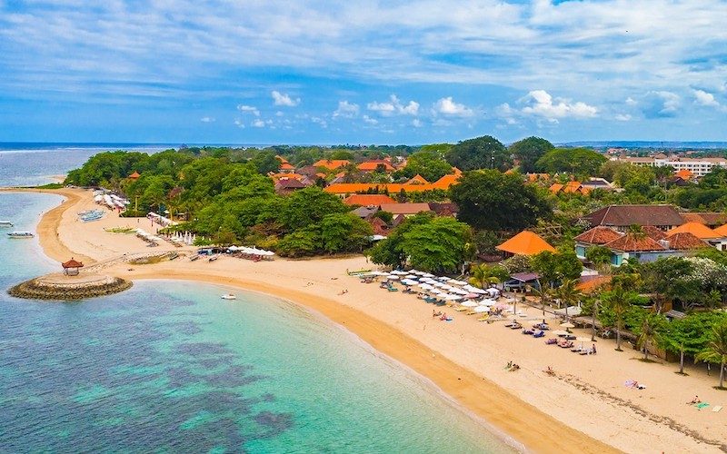
Located on the southeastern coast, Sanur is the refined “Sunrise Coast” and serves as the most logical gateway for the modern explorer. On a Bali map, Sanur sits at a crossroads between the airport, the cultural heart of Ubud, and the eastern offshore islands.
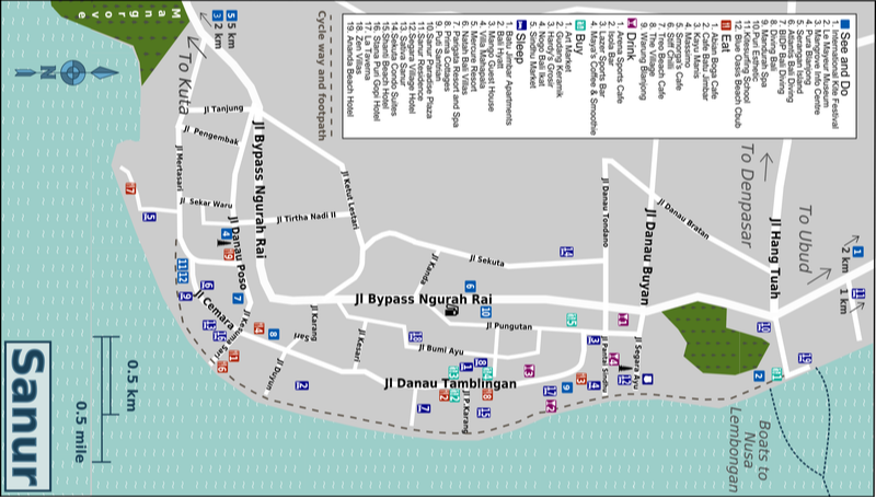
It was the original home of Balinese tourism in the 1960s, and today it has returned as a sophisticated hub for those seeking a balanced lifestyle. The area is defined by its five-kilometer paved beachfront promenade, where the rhythm is dictated by the sunrise and the gentle lap of the lagoon waters.
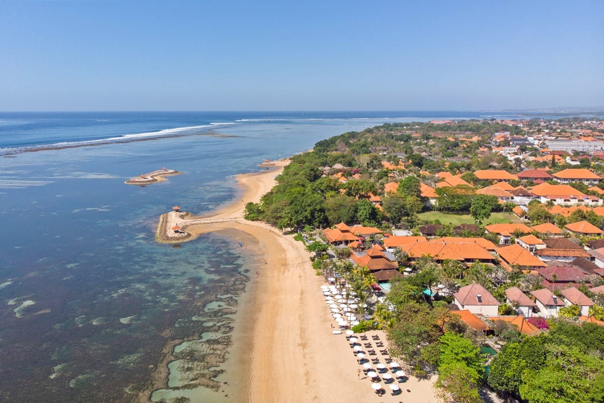
Sanur’s unique value on the Bali map lies in its protection by an offshore coral reef, which creates a shallow, wave-free environment ideal for families and wellness seekers. The district is currently home to the Sanur Special Economic Zone, which has brought international standards of healthcare and wellness technology to the island.
For the sophisticated traveler, Sanur offers a mature, peaceful environment that avoids the frenetic congestion of the west coast while providing unparalleled connectivity to the rest of the island.
Ubud: The Cultural and Green Heart
Moving toward the center of the Bali map, the landscape transforms into a verdant patchwork of emerald rice terraces and deep river valleys. Ubud is the spiritual and artistic heartbeat of Bali, situated at an elevation that provides cooler air and a sense of forest-clad tranquility. It is a mandatory stop for those wishing to explore the island’s traditional side, home to world-class art museums, yoga retreats, and the sacred Monkey Forest.
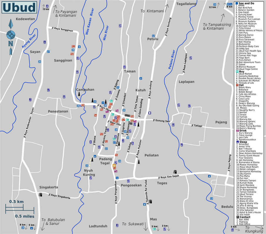
Ubud’s geography is dominated by deep ravines and lush rainforests, creating a mystical atmosphere that has attracted creative visionaries for decades. While it lacks a coastline, its central position on the Bali map makes it an excellent location for day trips to the northern waterfalls and volcanic lakes. For those seeking cultural depth and introspective quietude, the central uplands offer a profound sanctuary that complements the breezy luxury of the coast.
Nusa Dua: The Southern Peninsula
In the southernmost part of the Bali map, Nusa Dua is a manicured, secure enclave of world-class resort brands. This gated district was specifically designed to offer a “bubble” of luxury, featuring pristine white-sand beaches that are meticulously maintained by the resort management. It is the premier choice for large-scale international conferences and travelers who prioritize a guaranteed standard of safety and unostentatious luxury.
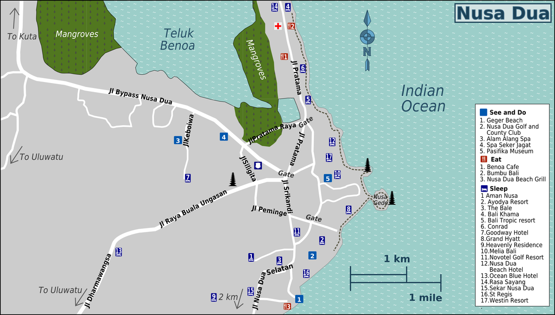
The waters of Nusa Dua are generally calm and suitable for swimming, though they lack the village-like authenticity of Sanur. On your Bali map, this area is isolated from the main traffic corridors, ensuring a very quiet and predictable holiday experience. It is a fantastic destination for families who want expansive pool complexes and kid-focused facilities in a secure, park-like environment.
Seminyak and Canggu: The Vibrant West Coast
The western coast of the Bali map is where the island’s energy rises with the sunset. Seminyak is the established capital of lifestyle and fashion, characterized by high-end boutiques, renowned beach clubs, and sophisticated fine-dining establishments along Jalan Laksmana. Just north of Seminyak lies Canggu, a younger and more bohemian district that has recently seen a significant surge in luxury villa development.
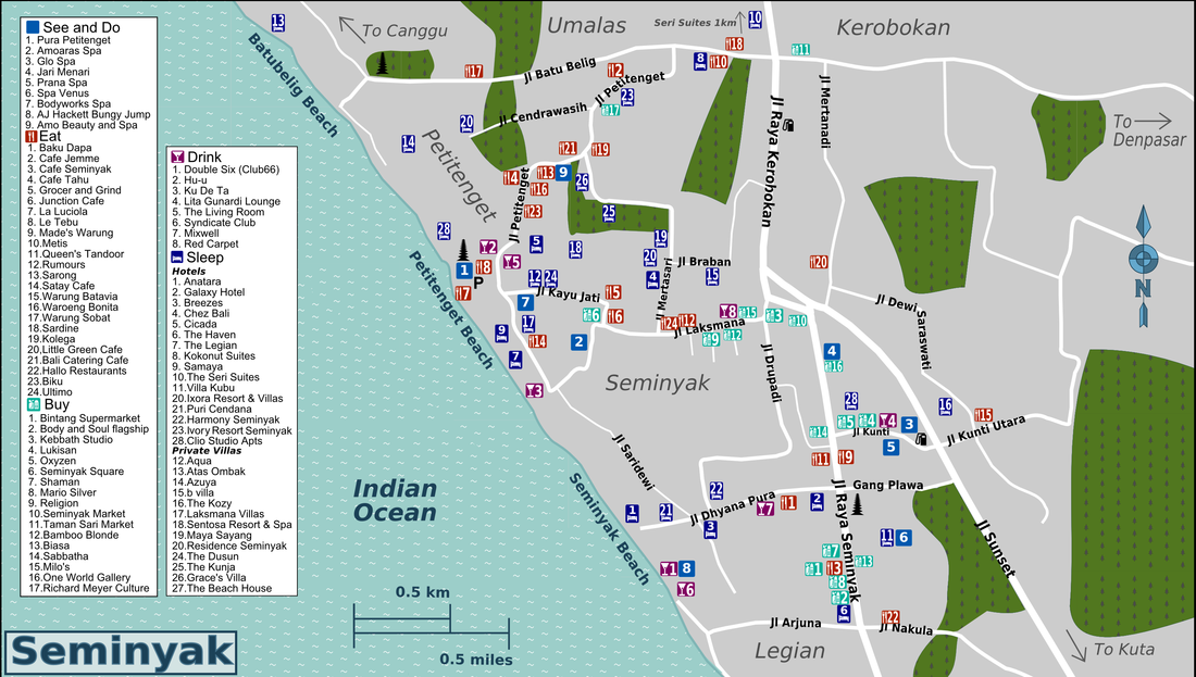
This coastline is defined by powerful surf and dramatic sunsets, attracting a social and design-conscious demographic. While these areas are highly fashionable, they often experience heavy traffic and a faster pace of life. For travelers whose primary goal is to be at the center of Bali’s social and culinary trends, the west coast offers a dynamic environment that contrasts sharply with the serenity of the sunrise coast.
Uluwatu: The Dramatic Southern Cliffs
Uluwatu sits on the rugged limestone cliffs of the southern tip, offering some of the most spectacular ocean vistas on any Bali map. This region is famous for its cliff-top temples, such as Pura Luhur Uluwatu, and its world-class surf breaks that attract professional riders from across the globe. The vibe here is spread out and adventurous, with exclusive cliff-edge villas providing a sense of cinematic grandeur.
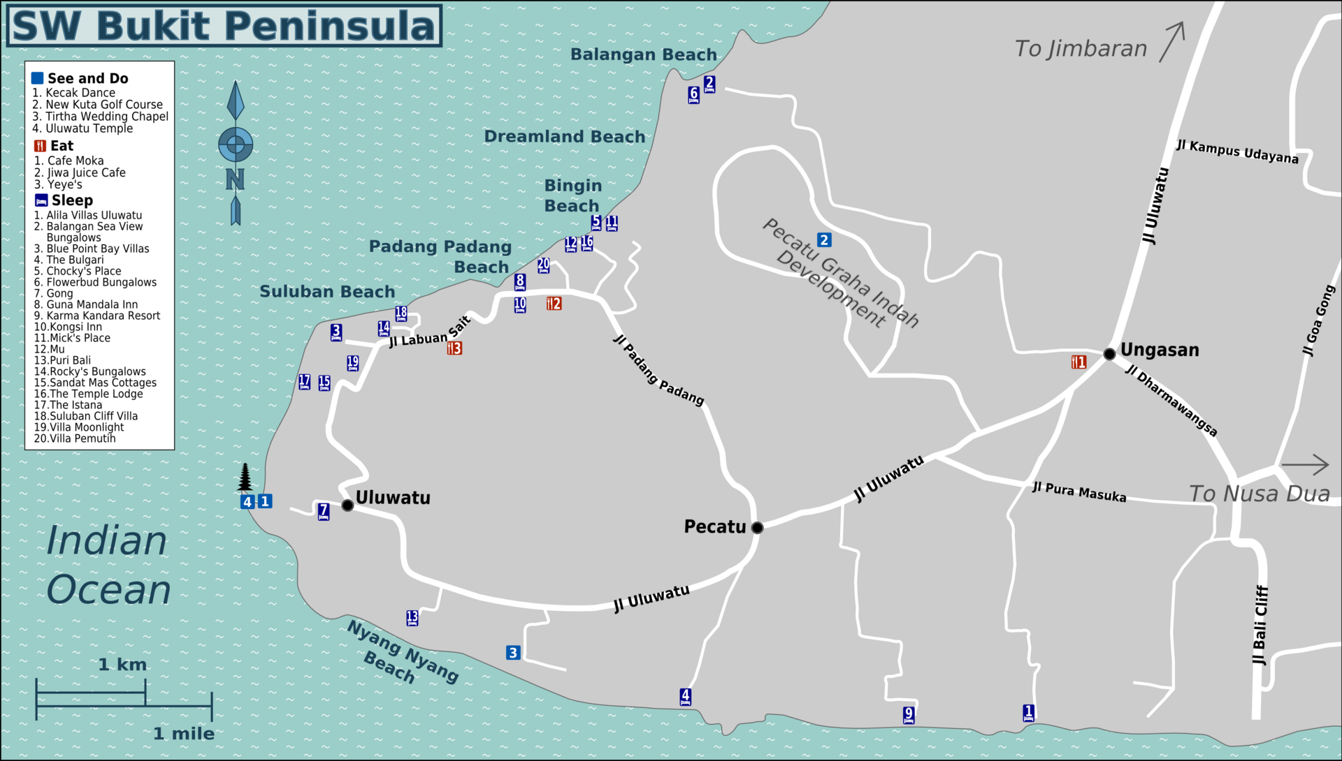
The scenery in Uluwatu is characterized by rocky outcrops and hidden coves, often accessible only via steep staircases. It is a region of raw natural power, where the Indian Ocean crashes directly against the island’s base. For those seeking a romantic and dramatic escape with wide, panoramic ocean views, the southern cliffs are an essential addition to a high-end Bali itinerary.
Strategic Distance and Travel Planning
A vital part of utilizing a Bali map is understanding the time required to move between different regions. Traffic patterns in 2026 can vary significantly, making a strategic home base essential for a stress-free holiday.
Comparison of Travel Times from Sanur
Sanur’s location on the eastern bypass makes it the most efficient hub for island exploration. Below is a summary of typical travel times from the Sanur complex to other major landmarks on the Bali map.
| Destination | Distance from Sanur | Approx. Travel Time | Best Method |
| Denpasar City | 8 km | 15 to 20 minutes | Car or Scooter |
| Bali International Airport | 15 km | 25 to 30 minutes | Bali Mandara Toll |
| Ubud Center | 25 km | 45 to 60 minutes | Private Driver |
| Nusa Dua Enclave | 20 km | 30 to 40 minutes | Bali Mandara Toll |
| Uluwatu Cliffs | 35 km | 60 to 75 minutes | Private Driver |
| Nusa Penida Island | 25 km (Sea) | 35 to 45 minutes | Sanur Port Fast Boat |
| Bedugul Lakes | 55 km | 90 to 120 minutes | Private Driver |
Note: These travel times are based on 2026 traffic averages and may vary depending on religious ceremonies or peak holiday periods. Utilizing a private resort transfer is highly recommended to ensure GPS reliability and professional navigation.
Top Cultural Landmarks by Region
Every area highlighted on the Bali map offers its own set of must-visit cultural and historical sites. Understanding where these are located relative to one another helps build a cohesive, unhurried schedule.
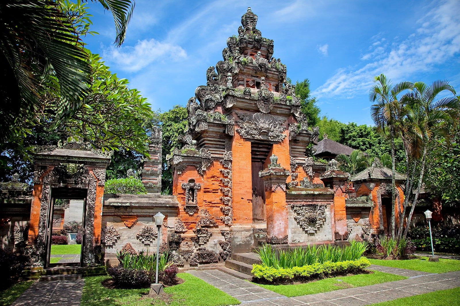
- East Coast (Sanur/Denpasar): Blanjong Temple (oldest relic), Bajra Sandhi Monument, Le Mayeur Museum, and the Sutasoma Lounge.
- Central Highlands (Ubud): Tegalalang Rice Terraces, Pura Taman Saraswati, ARMA Museum, and Tirta Empul (holy springs nearby).
- Southern Tip (Bukit): Uluwatu Temple (Sunset Kecak), GWK Cultural Park, and Padang Padang Beach.
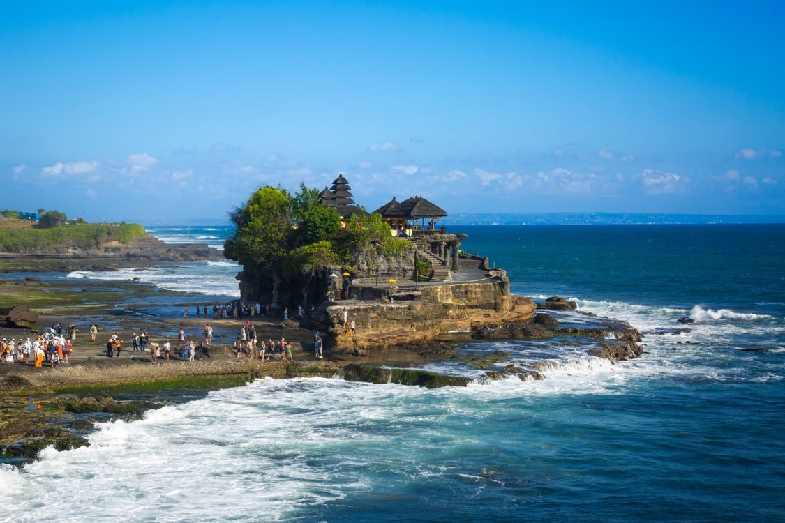
- West Coast (Seminyak/Canggu): Tanah Lot Temple (Sunset), Petitenget Temple, and various modern architectural beach clubs.
- Northern Frontier (Bedugul/Munduk): Ulun Danu Beratan Temple, Sekumpul Waterfall, and various clove plantations.
A Regional Guide to Bali’s Natural Landscapes
Understanding the island’s diversity is easier when you categorize its regions by their primary environmental characteristics. While the south is famous for its infrastructure, the rest of Bali is a treasure trove of varied ecosystems and hidden attractions.
| Region | Primary Landscape | Signature Experience | Travel Time from Sanur |
| North Bali | Volcanic Black Sand | Dolphin Watching and Diving | 3 to 4 Hours |
| East Bali | Coastal Cliffs and Peaks | Ancient Palaces and Reefs | 1.5 to 2.5 Hours |
| West Bali | National Park Wilderness | Wildlife Tracking and Seclusion | 3.5 to 5 Hours |
| Central Bali | Rainforests and Valleys | Rice Terraces and Waterfalls | 1 to 1.5 Hours |
1. East Bali: The Gateway to Tradition
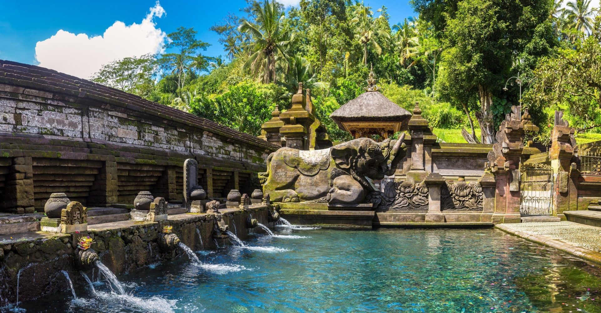
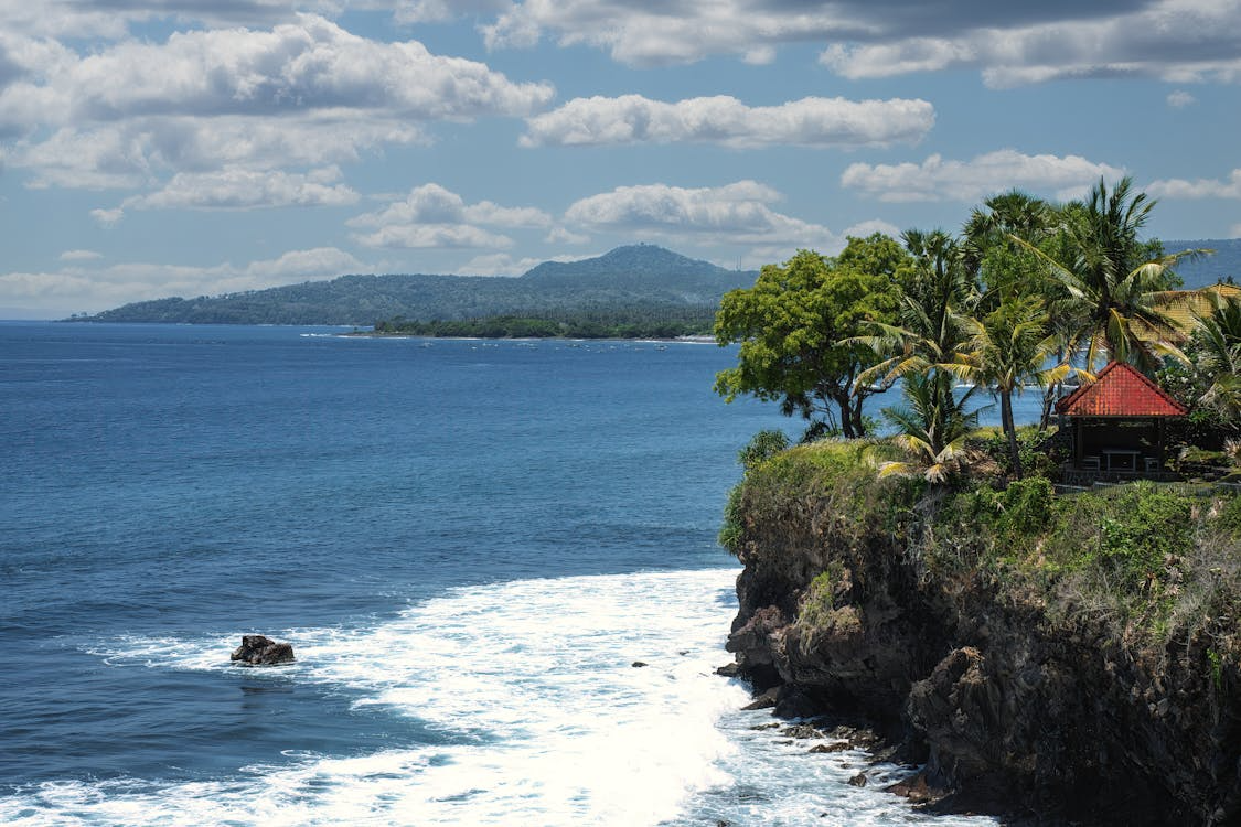
When you trace the coastline of your Bali map north from Sanur, you enter the Karangasem Regency, a region defined by its regal history and the dominant presence of Mount Agung. This area is home to the island’s most significant water palaces, such as Tirta Gangga and Taman Ujung. These sites were built by the late Raja of Karangasem and feature a unique blend of Balinese and European architecture, surrounded by expansive koi ponds and manicured stone pathways.
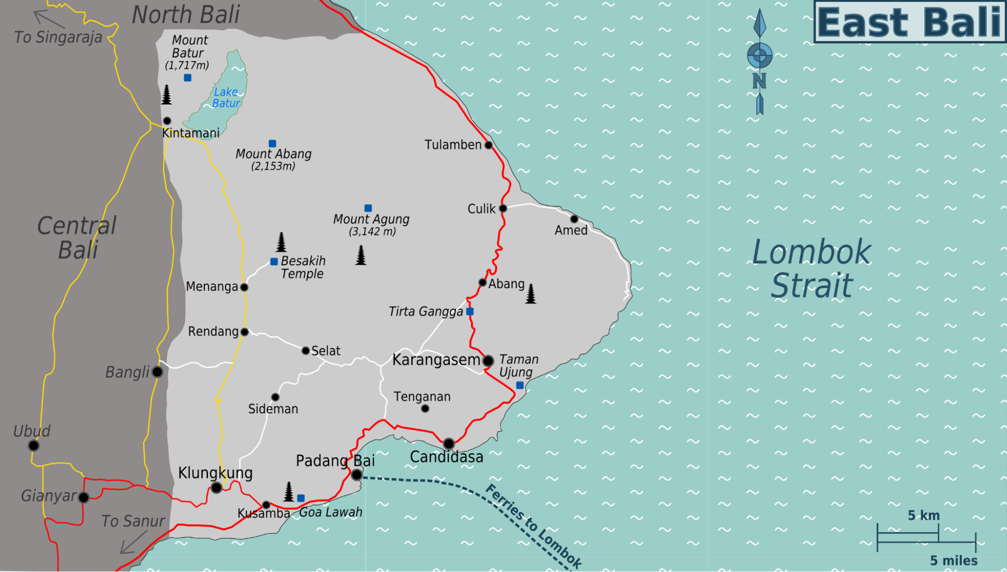
For divers and snorkelers, the village of Amed on the far eastern tip of the Bali map is a mandatory destination. The shoreline here is characterized by dramatic black volcanic pebbles and crystal clear water that houses the historic USAT Liberty shipwreck in nearby Tulamben.
The pace of life in the east remains deeply traditional, with local families continuing to practice artisanal salt farming and traditional weaving. Staying in Sanur provides the most efficient access to this region, allowing you to depart early in the morning and explore the eastern palaces before the afternoon heat sets in.
2. North Bali: The Quiet Frontier
The northern coast, primarily the Buleleng Regency, offers a sharp contrast to the busy southern hubs. On your Bali map, this region appears as a long stretch of black-sand beaches, with Lovina as the main center for eco-tourism.
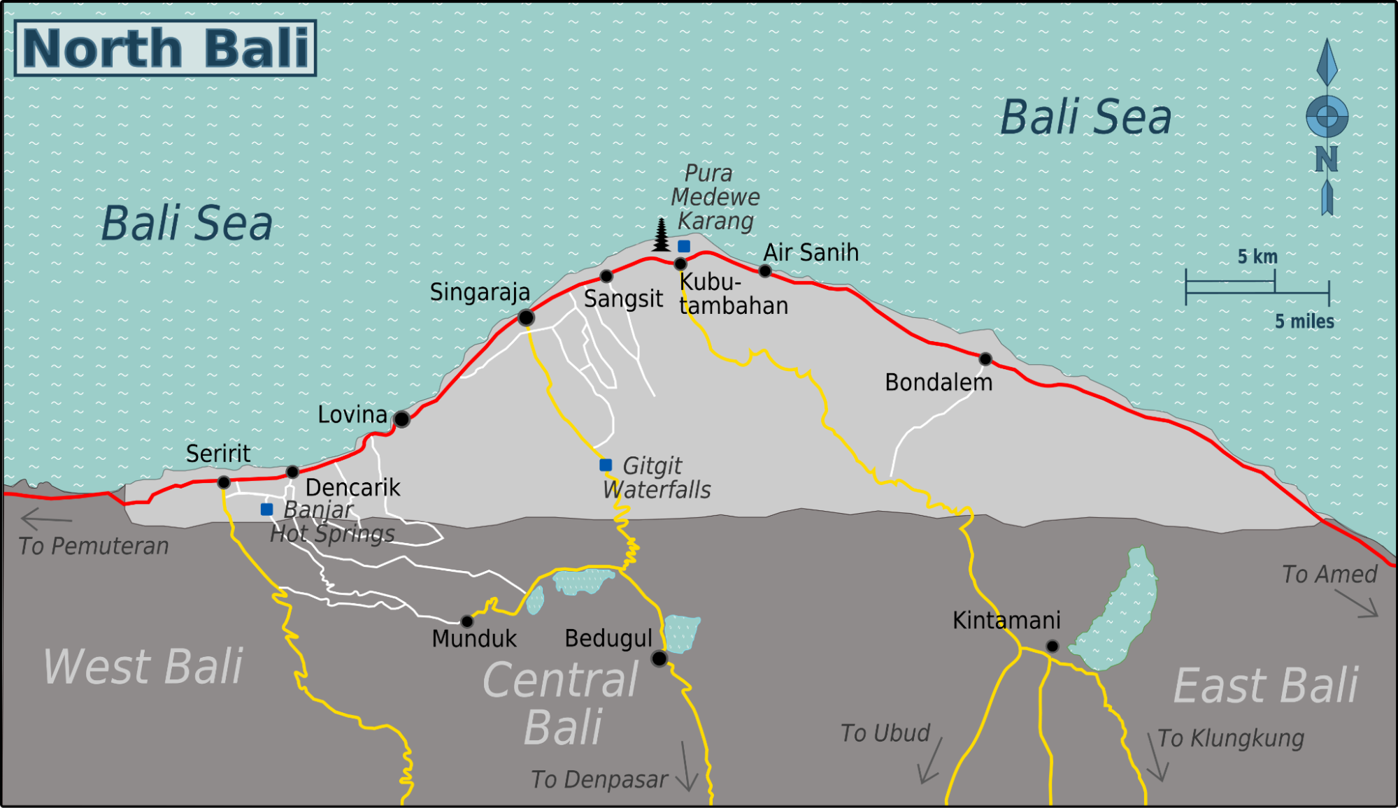
Lovina is globally famous for its sunrise dolphin tours, where traditional boats take guests out to see hundreds of wild spinner dolphins playing in the calm morning waters. The water here is significantly warmer and flatter than on the west coast, making it ideal for young children or those seeking a more relaxed marine encounter.
Moving inland from the north coast, you ascend into the village of Munduk, a place often shrouded in mist and surrounded by clove and coffee plantations. Munduk is the best area on the Bali map for trekking to spectacular hidden waterfalls, such as Munduk Waterfall and Melanting Waterfall. The air here is thin and crisp, often requiring a light sweater even during the height of the dry season. This region provides a sense of “Old Bali” that is increasingly hard to find, offering a quiet, introspective environment for travelers who value nature and solitude above all else.
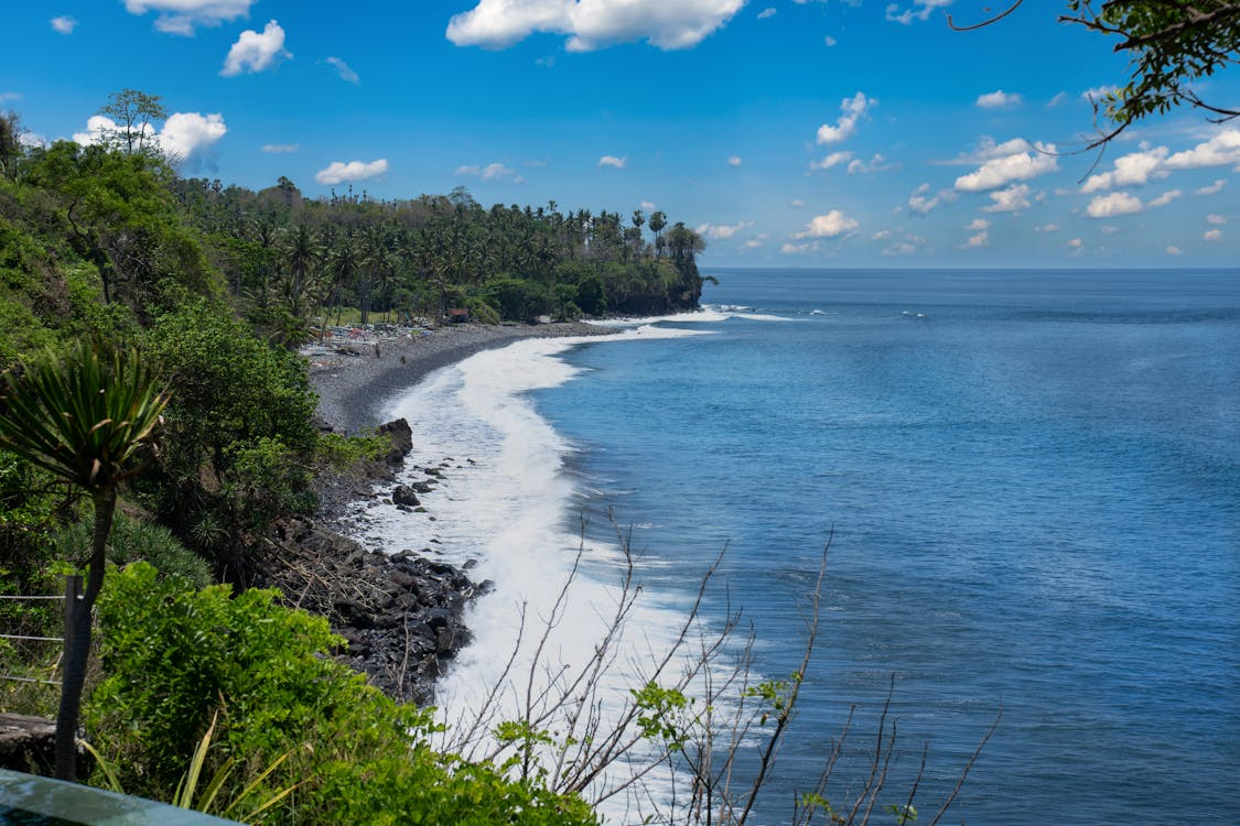
3. West Bali: The Wilderness Frontier
The far western reaches of the Bali map are dominated by the Bali Barat National Park, a 19,000-hectare conservation area that remains the island’s most untouched wilderness. This is the only place in the world where the critically endangered Bali Starling can be seen in its natural habitat. The park features diverse ecosystems, including primary monsoon forests, mangroves, and savannahs. Visitors can engage in guided birdwatching tours or track wild deer along the coastline of the Menjangan Island marine protected area.
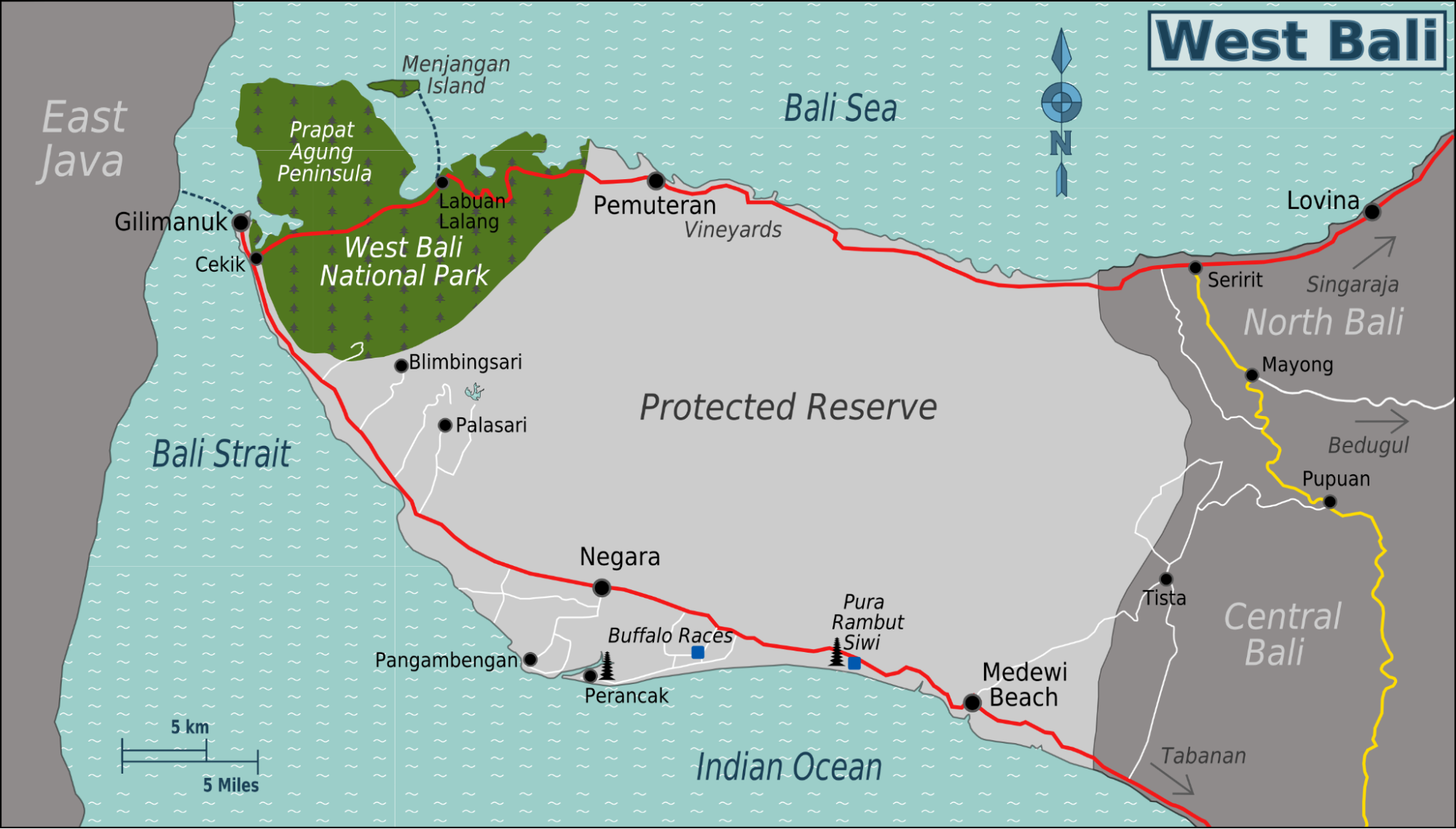
Menjangan Island is often cited as the premier location for wall diving and snorkeling in Bali. The underwater cliffs are covered in massive sea fans and vibrant sponges, offering visibility that can often reach thirty meters. Because the west is the most remote part of any Bali map, it attracts travelers who seek total seclusion and a deep connection to the raw natural world.
Where to Stay at the Strategic Center of the Island
When studying the Bali map, it becomes clear that the eastern coastline offers the most logical base camp for exploration. The Bali Beach Hotel anchors this accessible center, offering a tranquil, heritage-rich environment that connects you seamlessly to the airport, northern cultural sites, and eastern offshore islands.

As a member of The Heritage Collection and an icon of Indonesian progress, the hotel serves as a cultural diplomat, providing a majestic setting that honors the nation’s history and artistry on a grand scale.

The Bali Beach Hotel is more than just a place to sleep; it is a landmark. Originally inaugurated in 1966 by President Soekarno, the property has undergone a monumental revitalization, blending its mid-century modern roots with 2026 luxury standards.
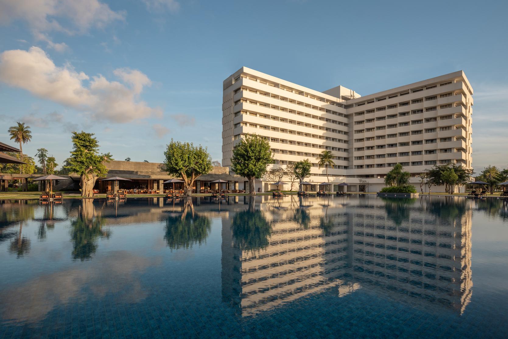
Our hotel stands as one of Bali’s most iconic landmark towers, rising 10 stories and offering an elevated vantage point, with all rooms and suites designed with ocean-facing views. This significant scale is matched by extensive facilities, making it a powerhouse for travelers seeking a premier family destination with variety and space.

Our suite collection is engineered to provide an unparalleled balance of space and comfort. The Bali Beach Suite, situated on the 7th floor, is an elevated 175-square-meter retreat where elegance meets the stunning sunrise views of the coastline. Thoughtfully designed with a separate living and dining area, this suite offers a refined sanctuary that goes beyond the ordinary.

For those requiring the absolute highest standard of opulence, the Presidential Ocean View Suite spans a magnificent 380 square meters. This luxurious haven boasts a refined living room, an elegant dining area, and a dedicated work desk, ensuring that your stay is as productive as it is relaxing.
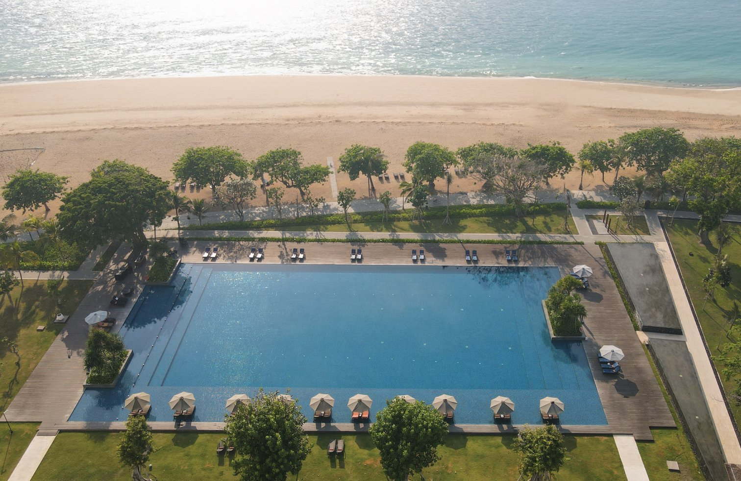
The facilities at the Bali Beach Hotel are grand in scale and designed for your total well-being. Guests can swim in the monumental Bali Beach Pool, spanning an impressive 57 by 37 meters and overlooking the Indian Ocean.
This is an ideal location for Sublue Water Scooter sessions or a quiet morning of aquatic fitness. For families, the Niskala Kids Club offers an educational approach to play, while the Sarinah store offers a curated selection of high-end Indonesian artistry.
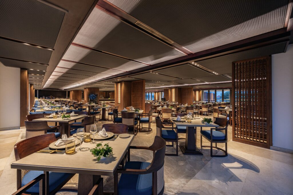
Dining is a central part of the heritage experience. Roso Restaurant honors the essence of Indonesia’s best cuisine, providing a fusion of traditional dishes spanning from Sabang to Merauke. Guests can also enjoy the Rasa Nusa tasting journey every Friday, an unlimited expedition through 22 signature dishes that capture the vibrant spirit of the nation.

For a quiet nightcap, the Sutasoma Lounge provides an exclusive library ambiance for reflection or high-level conversation.

To ensure your transition into this sanctuary is as effortless as possible, we invite you to book the Timeless Arrival and Stay package. This exclusive offer combines a luxurious two-night stay with a fully managed VIP airport experience via the Injourney Airport Service.
From the moment you exit the aircraft, our professional team will handle the logistics, including expedited immigration and luggage assistance, while you focus on unwinding. It is the definitive way to begin your Balinese odyssey with grace and monumental style, utilizing the most strategic point on the Bali map.
Conclusion
Navigating the Island of the Gods with a detailed Bali map reveals the interconnected nature of its diverse regions. From the spiritual depth of the central heart to the majestic heritage of the East Coast, every district offers a unique lesson in harmony and beauty.
We hope this 2026 guide provides you with the strategic clarity needed to plan an itinerary that honors both your adventurous spirit and your need for tranquility. Let the historic center of Sanur be your home base for an extraordinary island journey, where every direction leads to a new discovery and every evening brings you back to the comfort of a legendary coastal sanctuary.
FAQs
How long does it take to cross the island based on the Bali map?
Bali is larger than many visitors realize. The journey from the far south (Uluwatu) to the far north (Lovina) typically takes 3.5-5 hours, depending on traffic and road conditions. When studying your Bali map, always allow for extra time, especially when traveling through the central mountain passes.
Which area on the map is best for families and calm beaches?
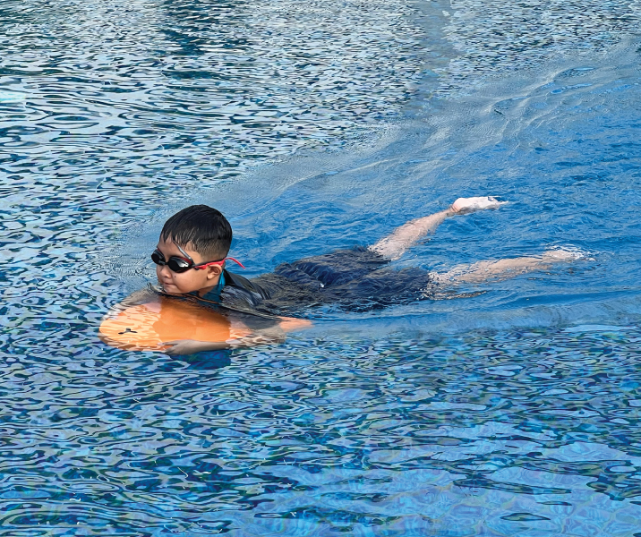
Sanur is a great option for families, thanks to its offshore coral reef which creates calm, shallow waters suitable for swimming. The area also features a long beachfront promenade, making it easy for walking, cycling, and getting around with children.
Are the main tourist attractions close to each other?
The attractions are distributed across the island. While Ubud has a high density of temples and forests, iconic sites like Tanah Lot (West), Uluwatu Temple (South), and Mount Batur (North) are separated by significant distances. This is why a central base on the Bali map, such as Sanur, is recommended to minimize total travel time.
Where are the main fast boat harbors located?
The primary and most modern harbor for fast boats to Nusa Penida and Nusa Lembongan is the Sanur Port, located at the northern end of Sanur Beach. On your Bali map, you will also find a traditional slow ferry terminal at Padang Bai for larger crossings to Lombok and the Gili Islands.
Which region offers the most authentic heritage experiences?
While authenticity is found throughout the island, Sanur offers a unique combination of 10th-century historical sites (like Blanjong Temple) and the 1960s dawn of Balinese tourism at the Bali Beach Hotel. For those seeking the “real” Bali, exploring the villages and temples highlighted on the Bali map around Sanur and Denpasar provides a deep connection to the island’s social and historical core.